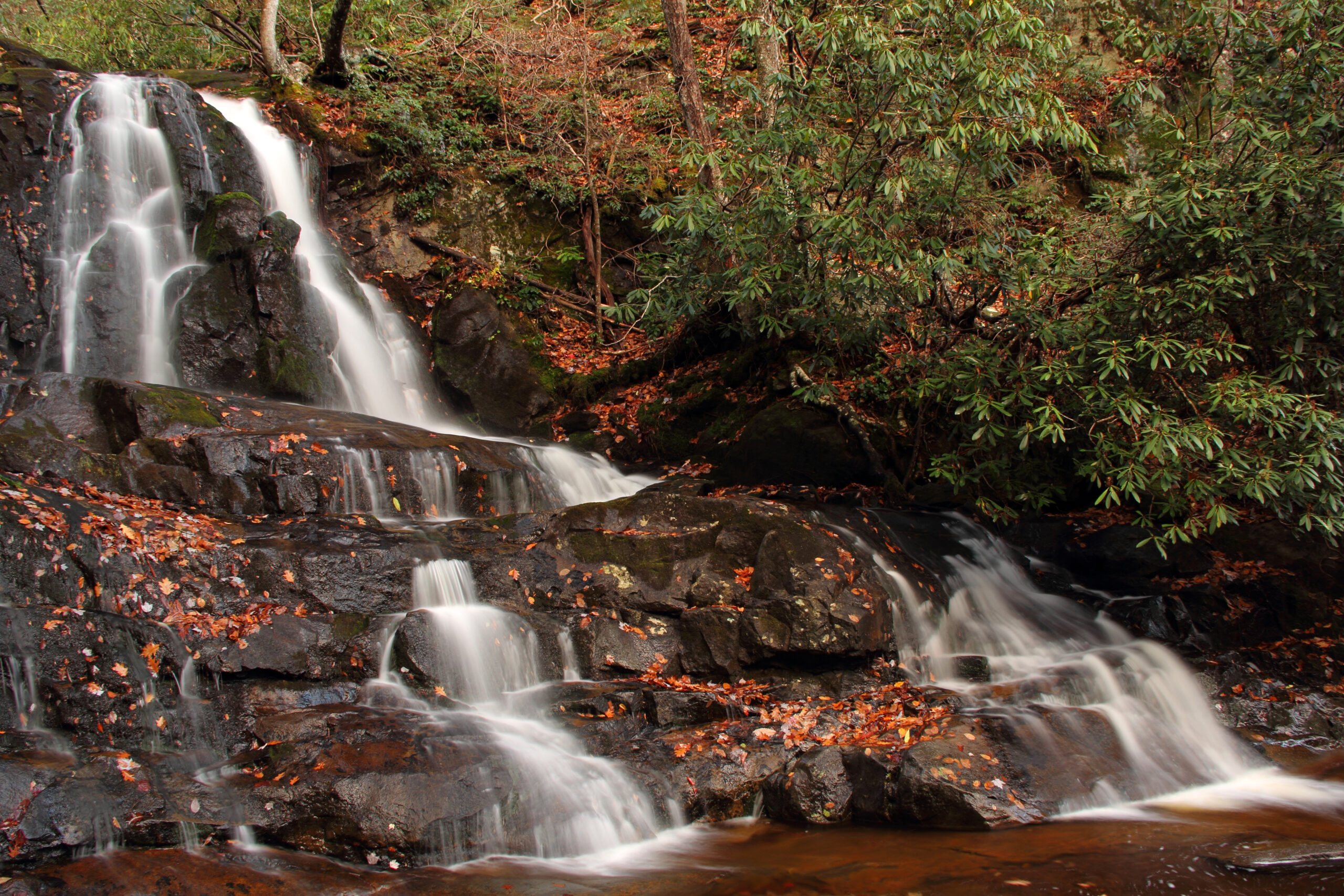
Laurel Falls – on Little River Road, located 3.8 miles west of Sugarlands Visitor Center near Gatlinburg.
Laurel Falls is a popular trail located within Great Smoky Mountains National Park, named after the rhododendron and mountain laurel bushes that along the path. While on the trail, hikers will be able to marvel at the majestic 80-foot-tall two-tiered waterfall, separated by a walkway crossing the Laurel Branch Stream at its base.
The Laurel Falls Trail was initially created in 1932 as an escape route for fire crews in the event of a forest fire on Cove Mountain. In 1935, the Cove Mountain Fire Tower was completed. As a result, the path began to attract a number of hikers. By the 1960s, heavy levels of erosion began to take its toll on the trail. As a result, the Department of Interior decided to pave the eroded part of the trail in 1963. It remains the longest and most well-known of the four paved trails in Great Smoky Mountains National Park. The paved surface is still somewhat bumpy and uneven, so extra care should be taken when it’s wet. Also, hikers should exercise caution around the steep edges of the path, as well as on the rocks around the waterfall, as their slippery texture, in combination with the algae present, has caused numerous injuries in the past.
For more information: https://www.nps.gov/grsm/planyourvisit/laurel-falls.htm
Comments are closed